Mambilla Plateau, Taraba: Facts, Climate and Notes
Nigeria’s highest plateau in Taraba State, with cool weather, tea farms and Chappal Waddi.
Last checked:
Quick facts
- State
- Taraba State
- Category
- Nature and wildlife
- Location
- Southeastern Taraba State, in Sardauna Local Government Area, bordering Cameroon on the southern and eastern escarpments
- Elevation
- About 1,600 m on average, the highest plateau in Nigeria per Wikipedia
- Highest point
- Chappal Waddi, 2,419 m
- Length and width
- About 96 km by 40 km
- Climate
- Daytime temperatures rarely above 25°C, with strong daytime winds; rainy season mid-March to end of November, over 1,850 mm a year
The Mambilla Plateau is in southeastern Taraba State, in Sardauna Local Government Area. Wikipedia describes it as Nigeria’s highest plateau. Its high elevation is associated with cool weather, and tea is grown there on a large scale.
About the plateau
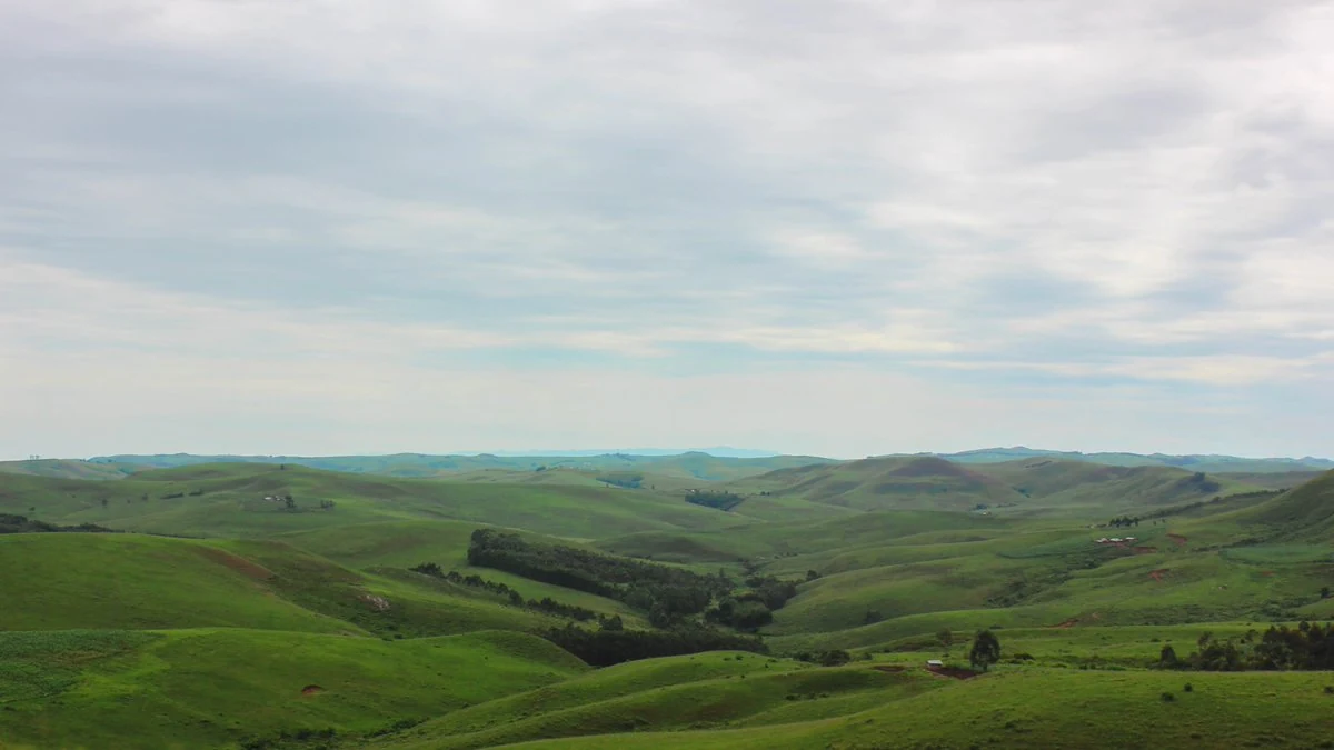
The plateau averages about 1,600 m above sea level and measures about 96 km long by 40 km wide. Its southern and eastern escarpments border Cameroon. Chappal Waddi, Nigeria’s highest point at 2,419 m, is on the plateau. The mountain is covered in our Chappal Waddi and Gashaka Gumti National Park guide.
Climate
According to Wikipedia, daytime temperatures rarely rise above 25°C, and strong winds occur during the day. The rainy season runs from mid-March to the end of November, with annual rainfall over 1,850 mm. The source attributes the plateau’s cool climate to its elevation.
Land and farming
The plateau is mainly covered by low grass, with planted eucalyptus forests. Tea is grown on a large scale. Wikipedia describes it as the only region in Nigeria that grows tea on this scale, while noting that the sector is mostly underdeveloped. Cattle are also plentiful.
People
The Mambilla are the original and main group on the plateau, with Fulani and Kaka the largest minorities. English is official, but most residents speak Mambilla as a first language. Fulfulde is used for trade.
Nearby protected areas
Gashaka Gumti National Park and Ngel Nyaki Forest Reserve are nearby protected areas.
Visiting
Our sources give no information on access, accommodation or fees, or on safety beyond the UK advice above. Access, guides, fees and opening times are not confirmed here. Wikipedia describes tensions between Fulani herders and the Mambilla. The travel warning above applies.
For further background on Nigeria’s wildlife areas, read about Yankari Game Reserve. Browse the wider places guide for other published place profiles.
Frequently asked questions
Where is the Mambilla Plateau?
In southeastern Taraba State, in Sardauna Local Government Area, bordering Cameroon along its southern and eastern escarpments.
Why is it cool?
Wikipedia attributes its cool climate to its elevation, averaging about 1,600 m. Daytime temperatures rarely rise above 25°C.
What grows there?
Low grass, planted eucalyptus forests and tea. Wikipedia describes tea as being grown on a large scale, though the sector is mostly underdeveloped.
Sources and further reading
Last checked
You might also like
Photo: Dotun55, CC BY-SA 4.0, via Wikimedia Commons. Cropped and compressed. Chappal Waddi and Gashaka Gumti National Park: Facts
Eastern Taraba and Adamawa states, bordering Cameroon · Nature and wildlife
Photo: Sani Maikatanga, CC BY-SA 4.0, via Wikimedia Commons. Cropped and compressed. Yankari Game Reserve
Bauchi State · Nature and wildlife
Is Nigeria safe to visit?
It depends on where you go. Lagos, where most first-time visitors land, is not covered by the UK government's travel warning, but UK and Canadian advice both ask visitors to take care.