Introduction: The Geometry of a Megacity
If you have ever stood on the pedestrian bridge at Ojota during rush hour, or sat in gridlock on the Third Mainland Bridge looking out over the lagoon, you have witnessed the defining structural reality of Lagos. It is not merely that the city is "busy" or "crowded" descriptions that could apply equally to New York or London. It is that Lagos is facing a geometric crisis unique among the world’s megacities.
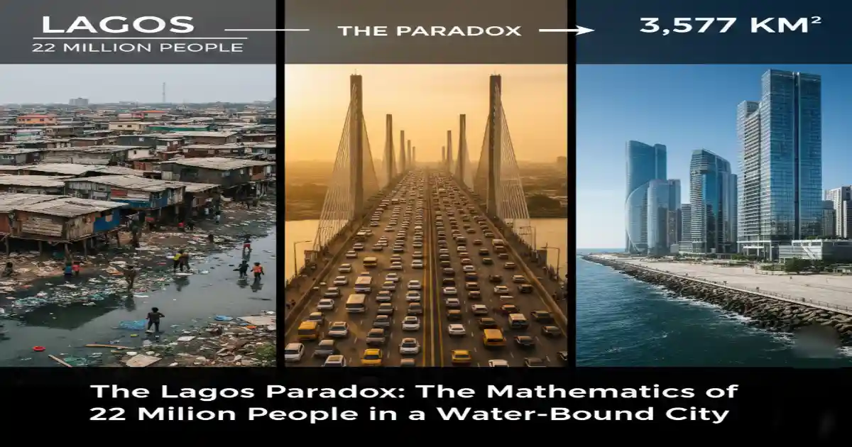
Lagos is an economic colossus built on a geographic bottleneck. It is the smallest state in Nigeria by landmass, yet it houses the largest population. While other megacities like Johannesburg or Dallas have the luxury of sprawling endlessly into vast, flat hinterlands, Lagos is hemmed in by the Atlantic Ocean to the south and a complex, stunning, but restrictive network of lagoons and creeks that swallow up to 22–25% of its total territory.
This creates a brutal "math problem." When you divide a contested population estimate of 17 to 24 million people by a severely restricted amount of dry, buildable land, you generate density figures that break standard urban planning models.
This article is not about the "vibes" of Lagos. It is a rigorous audit of the numbers. We will dissect the population disputes, calculate the real densities, and compare Lagos metric for metric against ten major global and African cities. The data reveals that Lagos’s challenges in housing, flooding, and traffic are not just failures of management; they are inevitable byproducts of trying to fit a country’s worth of people into a space smaller than Trinidad and Tobago.
Defining the Map: What Do We Mean by "Lagos"?
To understand the density crisis, we must first agree on the boundaries. Much of the confusion in policy debates stems from people using "Lagos" to mean three different things.
1. Lagos State (The Administrative Container)
This is the political entity created in 1967. It encompasses the bustling metropolis but also includes rural and semi-rural areas like Badagry in the west, Epe in the east, and Ikorodu to the north.
- Total Area: Approximately 3,577 km².
- The Catch: A massive portion of this is water. According to the Lagos State Ministry of Waterfront Infrastructure Development, water bodies (lagoons, creeks, rivers) account for roughly 22% to 25% of this area.
- Usable Land: If we subtract the water (~787 km²), we are left with roughly 2,790 km² of land for 22 million people.
2. The Lagos Metropolitan Area ("The City")
This is the functional city the continuous built-up area where the vast majority of the population actually lives and works. It stretches from the islands (Victoria Island, Ikoyi, Lagos Island) mainland-wards through Surulere, Ikeja, and up to the boundary with Ogun State.
- Area: Estimates for the built-up metro area vary, but reliable urban studies place it between 1,171 km² and 1,500 km².
- Significance: This is where the density is most crushing. We are effectively packing 85% of the state’s population into 37% of the state’s land.
3. The Urban Agglomeration (The UN Definition)
The United Nations "World Urbanization Prospects" ignores political borders. It looks at satellite imagery of night lights and continuous rooftops.
- Reality: Lagos has spilled over its own borders. Towns like Mowe, Ibafo, and Ota are politically in Ogun State, but economically and socially, they are Lagos dormitories. This "Mega-City Region" complicates the data because the people sleep in Ogun but strain Lagos infrastructure during the day.
The Demographics Debate: 17 Million or 24 Million?
You cannot plan a city if you do not know how many people live in it. Unfortunately, Lagos population data is a subject of intense political and methodological dispute.
The UN Estimate (The Conservative View)
The United Nations, using projections based on the controversial 2006 Nigerian Census, estimates the population of the Lagos urban agglomeration at approximately 17–18 million as of 2024/2025.
The Lagos State Government Estimate (The Service-Based View)
The Lagos State Government (LASG) vehemently rejects the UN figures. They argue the 2006 census undercounted Lagos. Using "proxy data" such as waste generation (tonnes per day), school enrollments, and polio immunization records LASG planners estimate the population is currently between 22 million and 24 million, growing at a rate of nearly 3.2% annually.
Why This Matters:
If the state plans for 17 million people (UN numbers) but 24 million show up (State numbers), the result is a perpetual deficit in housing, water, and road space. For the calculations in this post, we will provide ranges to respect both methodologies, but we will lean toward the higher density scenarios that align with the visible reality on the ground.
Lagos By The Numbers (Snapshot)
|
Metric |
Data Point |
Source |
|---|---|---|
|
State Land Area |
3,577 km² |
Lagos State Gov |
|
Water Coverage |
~22–25% (~779 km²) |
Min. of Waterfront |
|
Usable Land |
~2,798 km² |
Calculated |
|
Population (Low) |
17,800,000 |
UN WUP (2025 proj) |
|
Population (High) |
24,000,000 |
Lagos State Gov |
|
Avg. Density (State) |
~6,150 – 8,500 people/km² |
(Pop ÷ Usable Land) |
|
Metro Density |
~18,000 – 20,500 people/km² |
Based on Metro Area |
The Core Argument: Why Land Scarcity is the Root Cause
The popular narrative is that Lagos is "overpopulated." The more accurate urban planning assessment is that Lagos is under-serviced relative to its density. The lack of land acts as a multiplier for every other problem.
1. The Housing Supply Squeeze
In a city with abundant land, housing stays affordable because developers can just build further out (sprawl). In Lagos, "further out" often means "into the lagoon."
- The Cost of Sand: Because dry land is scarce, developers often have to reclaim land (dredging sand from the ocean to fill swamps). This is incredibly expensive.
- The Result: Formal housing is built only for the wealthy who can afford these reclamation costs (e.g., Eko Atlantic, Banana Island).
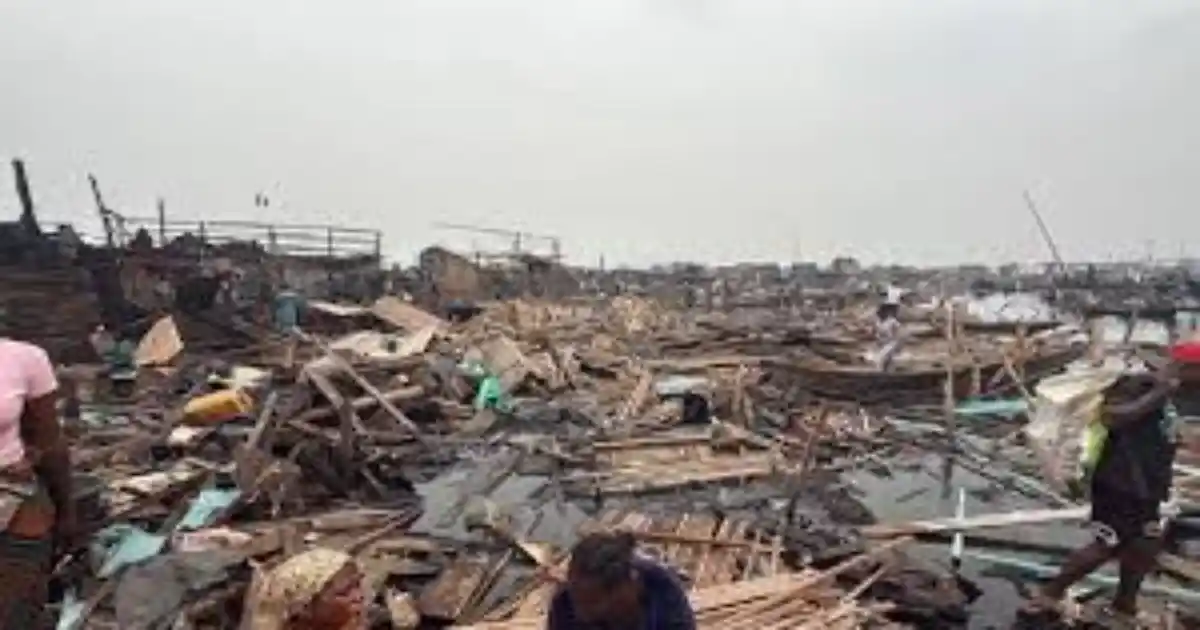
- The Slum Effect: The working class is pushed into "informal" settlements on marginal land swamps, canal setbacks, and floodplains. The World Bank estimates that two out of three Lagosians live in informal housing. This is not a choice; it is a function of land scarcity driving up the price of buildable plots.
2. The Transport Trap
Lagos is shaped like a funnel. The geography forces millions of people from the Mainland to commute to the Islands (Victoria Island/Ikoyi) where the majority of white-collar jobs are located.
- Choke Points: Because water splits the city, traffic cannot disperse. It is channeled onto three main bridges (Third Mainland, Eko, Carter). If one bridge fails or has an accident, the entire city gridlocks.
- Density vs. Roads: Lagos has a road density of about 2.2km per 1,000 people. Compare this to huge cities like Paris or New York, and the deficit is clear. The "Go-Slow" is a result of too many cars fighting for too few square kilometers of asphalt.
3. Drainage and The "Wetland" Conflict
Lagos was originally a wetland. As the population explodes, concrete replaces soil.
- Impermeable Surfaces: When it rains, the water has nowhere to go because the natural sponges (wetlands) have been paved over for housing.
- The Flooding Cycle: This leads to flash floods that paralyze the economy. It is a direct conflict between the need for land (housing) and the need for water management (drainage).
Comparative Analysis: Lagos vs. The World
To truly understand Lagos, we must place it side-by-side with its peers. We have selected 10 cities 5 from Africa and 5 Global heavyweights.
The Comparison Table
|
City |
Population (Est. 2024/25) |
Total Area (km²) |
Density (People/km²) |
Infrastructure Snapshot |
Key Structural Reality |
|---|---|---|---|---|---|
|
Lagos (Metro) |
17.8M – 22M |
~1,171 |
~15,200 – 18,000 |
Blue/Red Rail (New), BRT, Bridges |
Disadvantage: Trapped by water; expensive reclamation needed. |
|
Cairo (Egypt) |
22.6M |
3,085 (Metro) |
~7,300 |
Metro (3 lines), Ring Road |
Advantage: Desert allows unlimited outward expansion. |
|
Kinshasa (DRC) |
17.1M |
9,965 (Admin) |
~1,700 (Avg)* |
Limited Rail, Informal Transit |
Disadvantage: Vast sprawl with very poor road connectivity. |
|
Johannesburg |
6.3M (City) |
1,645 |
~3,800 |
Gautrain, Highways |
Advantage: Low density; land available for spread. |
|
Nairobi (Kenya) |
5.8M |
696 |
~8,300 |
Expressway, Matatus |
Advantage: Central location; room to grow South/East. |
|
Addis Ababa |
5.7M |
527 |
~10,800 |
Light Rail (LRT) |
Comparable: High density, land-locked. |
|
New York (USA) |
19.5M (Metro) |
12,093 (Metro) |
~1,600 |
Subway (24/7), Tunnel/Bridge |
Advantage: Massive metro area absorbs population. |
|
London (UK) |
9.7M |
1,572 |
~6,100 |
The Tube, Overground |
Advantage: Ancient rail network manages the density. |
|
Tokyo (Japan) |
37.1M |
13,555 |
~2,700 (Metro) |
Best-in-class Rail |
Lesson: Polycentricity (multiple city centers). |
|
Mumbai (India) |
21.6M |
4,355 (Metro) |
~5,000** |
Suburban Rail, Coastal Road |
Twin City: Also an island city with high slum density. |
|
Manila (Philippines) |
14.9M |
620 |
~24,000 |
Light Rail, Jeepneys |
Warning |
(Note on Data: Densities are calculated based on the Metropolitan or "Built-Up" area where possible to ensure fairness. Kinshasa’s density appears low because its administrative boundary includes vast rural areas, but its core is extremely dense. Mumbai’s density is lower on average but its core city density is among the highest in the world.)
1. Lagos vs. Cairo: Sand vs. Swamp
Cairo is Lagos’s closest competitor for the title of "Africa’s Largest City."
- The Difference: Cairo is surrounded by desert. While the heat is a challenge, the land is dry and stable. This has allowed Egypt to launch the "New Administrative Capital," a massive purpose-built city 45km east of Cairo.
- The Lagos Reality: Lagos does not have a "desert" to move to. Its expansion areas (Lekki/Epe) are largely wetlands that require expensive sand-filling. Lagos cannot simply "build a new city" as cheaply as Egypt can.
2. Lagos vs. London: The Infrastructure Lag
Interestingly, Greater London (1,572 km²) covers roughly the same land area as the Lagos Metropolis.
- The Gap: London hosts about 9 million people. Lagos hosts nearly double that (17–22 million) on the same amount of land.
- Survival Mechanism: London functions because of the "Tube" a subway system started in 1863. Lagos is only just launching its rail mass transit (Blue and Red Lines) in the 2020s. Lagos is attempting to manage double London's population with a fraction of London's transit infrastructure.
3. Lagos vs. Mumbai: The Spiritual Twin
If Lagos has a sister city, it is Mumbai.
- Similarities: Both are commercial capitals; both are coastal/island cities; both have a "film" industry (Bollywood/Nollywood); and both have massive informal settlements (Dharavi in Mumbai, Makoko/Ajegunle in Lagos).
- The Lesson: Mumbai moves 7.5 million people daily on its suburban rail network. It accepts high density and builds upward. Lagos is still largely a low-rise city (bungalows and duplexes). To survive, Lagos must follow Mumbai’s lead and go vertical, while improving on Mumbai’s sanitation struggles.
4. Lagos vs. New York City: The Myth of Size
People often compare Lagos to NYC, but geographically, they are distinct.
- The Difference: The New York Metro area is huge (over 12,000 km²). People commute from Connecticut, New Jersey, and Long Island.
- The Constraint: Lagos cannot easily expand into a "New Jersey" because its neighboring state (Ogun) requires crossing boundaries that have historically lacked integrated planning (though this is improving with the Lagos-Ogun Joint Development Commission).
What Lagos Can Do Next (Solutions, Not Vibes)
Lagos cannot manufacture more land without ecologically risky reclamation. Therefore, the solution lies in efficiency. The "Math Problem" must be solved by changing the variables of density and movement.
Phase 1: The "Now" (0–2 Years) Radical Water Transport
Lagos is 25% water, yet 90% of movement is by road. This is a waste of a natural highway.
- Proposal: Scale up the Lagos State Waterways Authority (LASWA). We need more than just small speedboats. We need high-capacity ferries (carrying 200+ people) running scheduled routes like a "Water Metro" from Ikorodu to Marina and Badagry to Liverpool (Apapa).
- Why: It requires no paving, no land acquisition, and relieves pressure on the bridges immediately.
Phase 2: The "Next" (3–7 Years) Transit-Oriented Zoning
The new Blue Line (Rail) and Red Line are excellent starts. But a train line alone is not enough.
- Proposal: Implement Transit-Oriented Development (TOD). The government must re-zone the 500-meter radius around every new train station.
- The Shift: In these zones, ban single-family bungalows. Mandate high-rise mixed-use buildings (10–20 floors) with affordable apartments.
- Goal: Allow 100,000 people to live within walking distance of the rail, removing their cars from the road entirely. This is the "Tokyo Model."
Phase 3: The "Big Bet" (8–20 Years) The Fourth Mainland Bridge & Regional Integration
The proposed Fourth Mainland Bridge is essential, not just for traffic, but for land access.
- Proposal: The bridge must connect to the Lagos-Ibadan Expressway and open up the Ikorodu-Epe axis.
- Regional Planning: Lagos must treat Ogun State not as a neighbor, but as an extension. A joint "Mega-Region Transport Authority" should manage rail and bus networks that cross the border seamlessly, allowing people to live in the vast lands of Ogun while working in Lagos, connected by high-speed rail.
Frequently Asked Questions (FAQs)
Q1: Is Lagos the largest city in Africa?
Answer: It depends on your definition. If you count the "Urban Agglomeration" (the continuous blob of city lights), Lagos and Kinshasa are neck-and-neck for the top spot, having both surpassed Cairo recently. However, Cairo's wider "Metro Region" is often still cited as larger due to established satellite cities.
Q2: Why does Lagos flood so much?
Answer: It is a combination of geography and behavior. Lagos is a coastal city with a high water table. But the severity of flooding is due to the "concreting" of the city building over wetlands that used to absorb water and the clogging of drainage channels with solid waste.
Q3: Is Eko Atlantic City the solution to land scarcity?
Answer: Not for the average citizen. Eko Atlantic (9 million square meters of reclaimed land) prevents coastal erosion and provides high-end real estate, but it is too expensive to solve the housing crisis for the masses. It is a commercial solution, not a social one.
Q4: How dense is Lagos compared to the countryside?
Answer: Extremely. The average population density of Nigeria is about 226 people/km². Lagos State’s density is over 6,000 people/km² (conservative estimate). It is a pressure cooker compared to the rest of the nation.
Q5: Can Lagos stop the migration?
Answer: No. People move to Lagos for economic survival. As long as Lagos holds 60% of Nigeria’s industrial and commercial capacity, the youth will keep coming. The solution is not to stop them, but to build a city that can absorb them.
The Optimism in the Numbers
The data paints a harsh picture: Lagos is a city fighting against its own geography. It is squeezed by water, swamped by wetlands, and overwhelmed by demographics.
However, recognizing the "math problem" is the first step to solving it. Lagos is not doomed; it is merely in a painful transition. The comparisons with Tokyo and Mumbai show that high density can be livable if it is managed with vertical construction and mass transit.
The "Go-Slow" is not a curse; it is a signal that the current horizontal model has failed. The future of Lagos is not on the road it is in the air (high-rises), on the water (ferries), and on the rails. If the state can pivot its planning to match its population, Lagos has the human energy to become not just an African giant, but a global one.